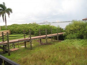
 The Florida Legislature created the mangrove trimming act, Chapter 403.9321 FS, 1996 Mangrove Trimming and Preservation, in which they defined an exemption based on measurements from the “shoreline”. The intent of the Legislature included the prevention of defoliation of mangroves and the riparian rights of property owners which includes their view of Florida waters. One of the exemptions in this rule is based on the width of the mangroves from the “shoreline”. Every statute or rule has a definition section. The definition section of this rule has eight terms defined and none of them includes the definition of shoreline. The Florida Department of Environmental Regulation is the oversight agency for this Act and has not written a companion rule for this Statute. Therefore, everything DEP needs to administer this Act must be in the text of Chapter 403.9321 FS. People are being denied their right to qualify for an exemption as DEP has set a policy to define “shoreline” as the wetland line as defined in Chapter 62-340 FAC. The extent of the wetlands on a bay or the gulf is not necessarily the shoreline. Florida DEP has an elaborate methodology (34 pages) for determining the landward/upper edge of a wetland. No where in this rule is there a definition of shore or shoreline.
I have to believe the definition of shoreline was self-explanatory or the Legislature would have included a definition for it. “Shoreline” is a surveying/engineering term that has been used for many years and is also defined by the Bureau of Land Management. The shoreline is the intersection of a specified plane of water with the shore or beach (Bureau of Land Management). The American Congress on Surveying and Mapping and the American Society of Civil Engineers defined shoreas: the land which is covered or uncovered by the rise and fall of the normal tide. It is the strip of land between mean high water and mean low water lines. In its strictest use, the term applies only to the land along the tidal waters. The shoreline is defined as the line along which the land surface meets the water surface of the sea or ocean. Strictly speaking, it is not a line, but a narrow strip or area, embracing that part of the land surface which comes in contact with wave action both above and below the surface of the water. The term does not apply to tidal flats or marshes which are overflowed by the tides, but is essentially to strips where the land surface has an appreciable slope toward the water.
This picture provides a great example of the misuse of the definition of shoreline. In the area of these mangroves the mean high water elevation is approximately 0.72′. The back (landward) edge of the mangroves is 2.0′. The interface of the tidal waters and the land surface is in the middle of the mangrove trees. The elevation at the wetland boundary near the wall is approximately 3.0′. The owner of this property has been told they cannot qualify for the exemption.


